Red Caboose? What Red Caboose?
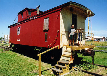 Someone recently asked me if there was a caboose (a red one) once located on the park property. I can say that yes, there was! Before I talk about this, though, I must first mention a little history.
In railroad history, a caboose (usually red for a reason) was located at the end of all trains. It was the office and sleeping quarters for three of the railroad workers, one conductor, the brakeman and the flagman. All of these workers had very specific jobs designated by their names.
With the advancement of technology in the 1970’s, trains began braking and signaling electronically. in 1982, the Railway Labor Act directed railroads to begin eliminating the cabooses where possible to do so, but in the process it also eliminated jobs.
Still, the popularity of cabooses was very high and many people did not want to see them go to waste. The idea arose to put them in parks and playgrounds, whenever and wherever possible. Because of this, one was donated to the YMCA in the early 1980’s and placed near the old day camp facility of of 90th Street. It was located by the forked path that leads to the dam and the esker. A playground was located by it named Arrowhead Playground. The day camp kids loved it!
The question always arises, just how did it get there … but I can’t talk about that! As far as to where it went, it was donated to Pioneer Park in Annandale.
So yes, Virginia ~ there was a caboose at the park!
Going on a Nature Walk
Since we began this adventure in 2006, many people have stopped to tell me that they love to walk through the Bertram Lakes property. When asked to describe their experience in one word, they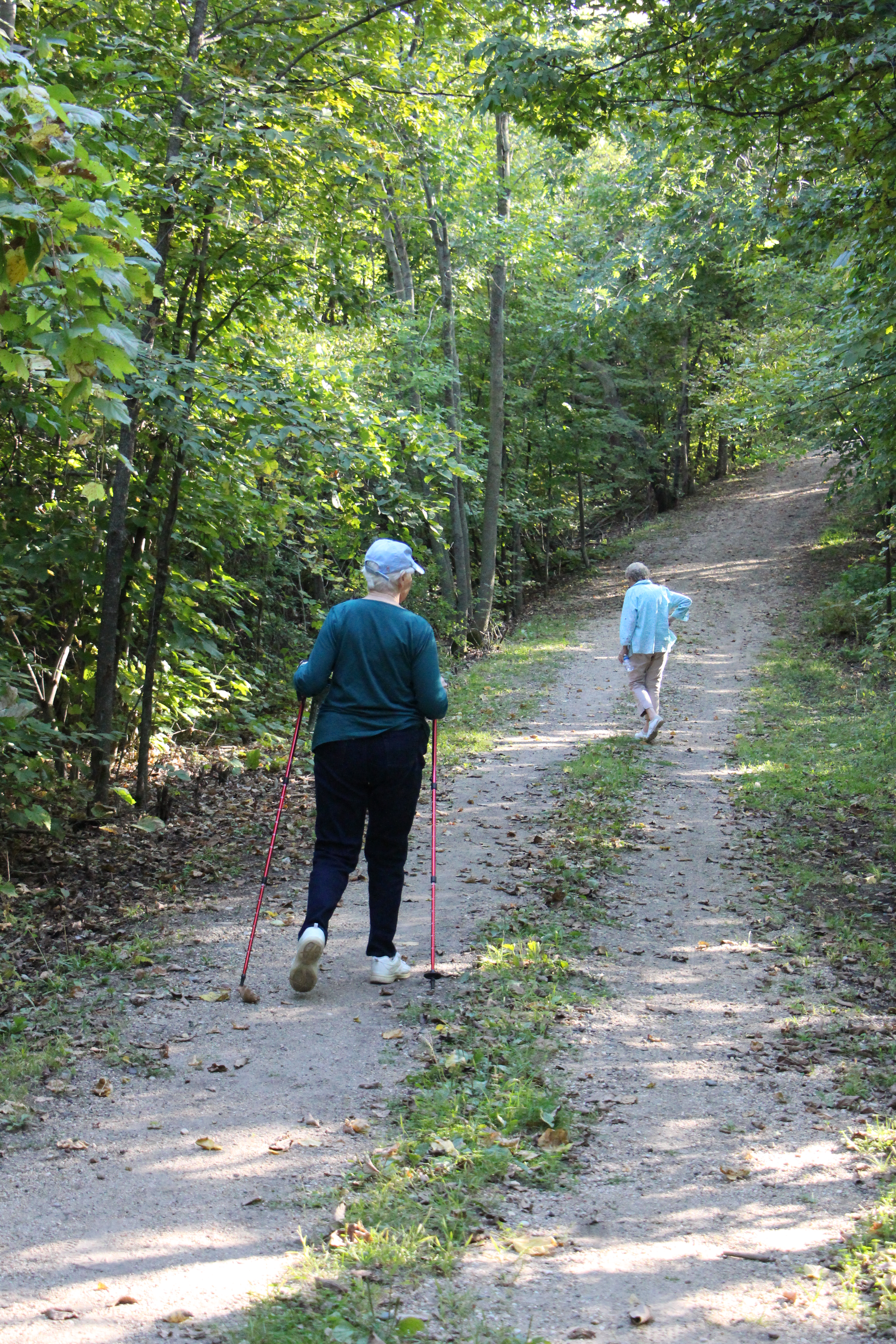 will say, “quiet, serene, beautiful, enjoyable, exercising, still, and renewing”. But … there are some rules to follow:
- Walk slowly.
- Spend 80% of the time looking up and around (unless you are looking for wildflowers or mushrooms).
- Open up all your senses, smell, see, hear, and feel what is being presented to you.
- Rest on a rock or stump and take in everything around you.
- Be aware of animals, birds, insects, trees, flowers, etc.
- Always check out something new.
There are many benefits to going on a walk through this beautiful property, some of which include:
- Relaxes the mind and body.
- Lowers stress, depression and anxiety.
- Increases attention span and memory.
- Provides exercise for the mind, body and spirit.
- Slows down our everyday pace.
- Gives us a peaceful feeling.
When going on a nature walk at Bertram park, here are just a few interesting things to look for:
- Glaciation: The park has three very special areas to be aware of,
- The “FEN”: A glacial lowland, a marsh located at the north end of Bertram Lake on the other side of the playground.
- The “KAME: A higher piece of land east of Long Lake. This is a perfect place to watch the emergence of the moon, planets and stars after sunset.
- The “ESKER”: Located between Long and Bertram Lakes, this high ridge of land is a perfect hiking area.
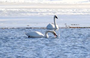
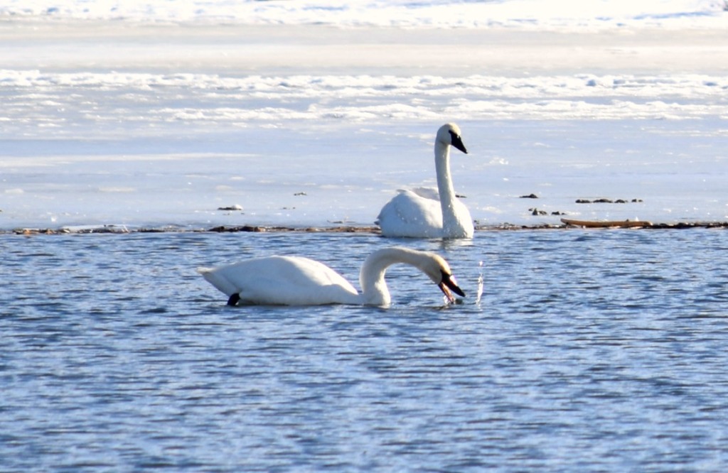
- Animal Life: Be aware of swans, loons, eagles, deer, beaver, and possibly river otter (for which Otter Creek is named).
- Flora: Trees of many varieties, wild flowers, mushrooms, etc.
Naturalist John Muir said it best, “in every walk with nature one receives more than he seeks”.
Whether it’s winter, spring, summer or fall, you’l always find something new to explore during your nature walks at Bertram!
Schools II
I have mentioned before that there were two country schools that serviced the students of the Bertram Lakes Area 125+ years ago. One was the Hanaford Country School which was located on Cahill Avenue, a fifth-mile south of County Road 106. This school was open from around 1870 to 1952. Then students began attending Oakwood School in Monticello. The Hanaford Country School was torn down some time in the 1970’s.
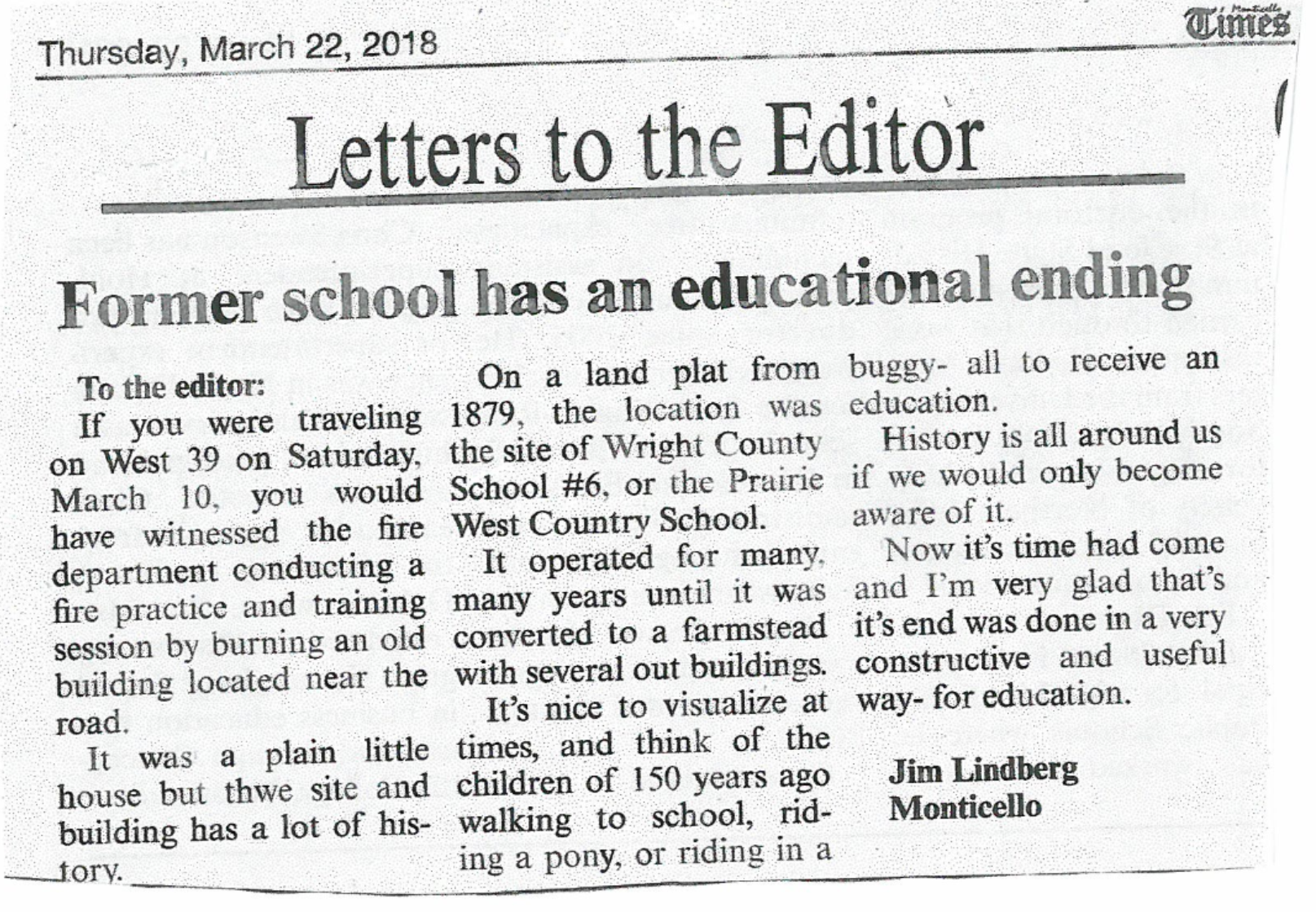
The second school was the Prairie West Country School located along County Road 39 West, approximately two miles from the I-94 underpass. The school met its demise on March 10, 2018. I wrote a letter to the editor of the Monticello Times which reads as follows:
These schools represent a time gone by, yet they also show that they were important in the development of the area.
Pine Plantations at the Park
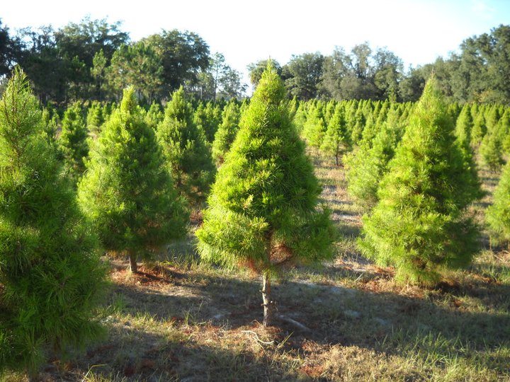 In an earlier tidbit I talked about the YMCA’s harvesting and sale of Christmas trees but I did not mention how this all came about. As the YMCA began purchasing land from the farmers surrounding the lakes, they also began talking about the creation of a Christmas Tree Farm to help them in their fundraising efforts. Since many of the fields were open areas (crops and pasture) they began massive plantings of seedlings of pine, spruce and fir to be used in the future as Christmas trees. The average time for seedlings to grow into usable Christmas trees is 7-9 years so the YMCA was very far-sighted in their plans. But in order to be the beautiful trees that people would buy for their families, the trees had to be groomed. This is a meticulous process that takes time and energy, mostly man hours because of the sheer number of trees. To accomplish the grooming, the YMCA had to use razor sharp machetes (knives) which were able to slice through the branches of the trees with ease.
Beginning in early June of each year, the YMCA would use the “knives” to top off excess growth from the year before. It had to be in June so the remaining branches could set the buds again for the new growth (usually 2-3 buds). In order to groom the trees, the men doing the work had to learn the proper way to prune the trees. Using the knife they had to make a sweeping motion from top to bottom following the angle of the tree to create the cone effect that was desired. They would work around the tree moving to the right and finish by lopping off 2/3 of the top spike. If the worker was left-handed, they would go left around the tree. The process not only created an aesthetically pleasing tree, but one with thicker branching (remember the 2-3 new buds).
The finished trees were usually harvested in early November each year. The men working had access to a bundling machine so they would put the tree through the machine which would compress the branches and encase them in a mesh for easier transportation. The Christmas tree harvesting went on for many years until the late 1980’s. After that, sales dropped due to the time, cost and commercialization of the Christmas tree business. The tree farm (or plantation) has since become mostly pine and new growth areas. In future years, the plan is to reforest some of the areas into the original Oak Savanna woodlands of the past. There is much to do to accomplish that transition.
The Source of Otter Creek?
A few months ago, I wrote about the importance of Otter Creek to the park. In that tidbit, it was stated that the creek’s source was in the swamp area southwest of Birch Lake. It was supposed to say the swamp area southeast of Birch Lake. But, by doing some further research and looking further into the archives at the Heritage Center in Buffalo, Minnesota, I have learned that this has not always been the case.
I located two maps; 1) An 1874 Andreas Atlas map; and 2) The Public Land Survey map of 1907. First, the 1874 map that shows three lakes – Bertram, Long and Mud as one. Otter Creek is shown running through all of the lakes as it does today, but it also shows something very different. Otter Creek is shown entering Bertram from the west but it then curves south, across 90th Street into North Cedar Lake and into Cedar Lake as its source.
Secondly, the 1907 Public Land Survey shows a similar pattern with one major exception – it shows Otter Creek coming into Bertram from the west but flowing through the swampy areas that exist today. It also shows the creek meandering from the south under 90th Street and coming from the Cedar Lake area. This map does not show roads but it is still easy to orient oneself.
So, the mystery continues ~ where exactly does Otter Creek begin?
• Has nature itself made changes?
• Have farmers and agriculture altered the land?
• Has technology in mapping improved?
• Are there other reasons?
Whatever the reason for the changes, we will always enjoy what we have.
Camping at Bertram
Camping at Bertram Lakes has been happening for over 100 years. The post card a friend gave me (earlier tidbit) shows a girl fishing at
the Bertram Beach in 1906. At that time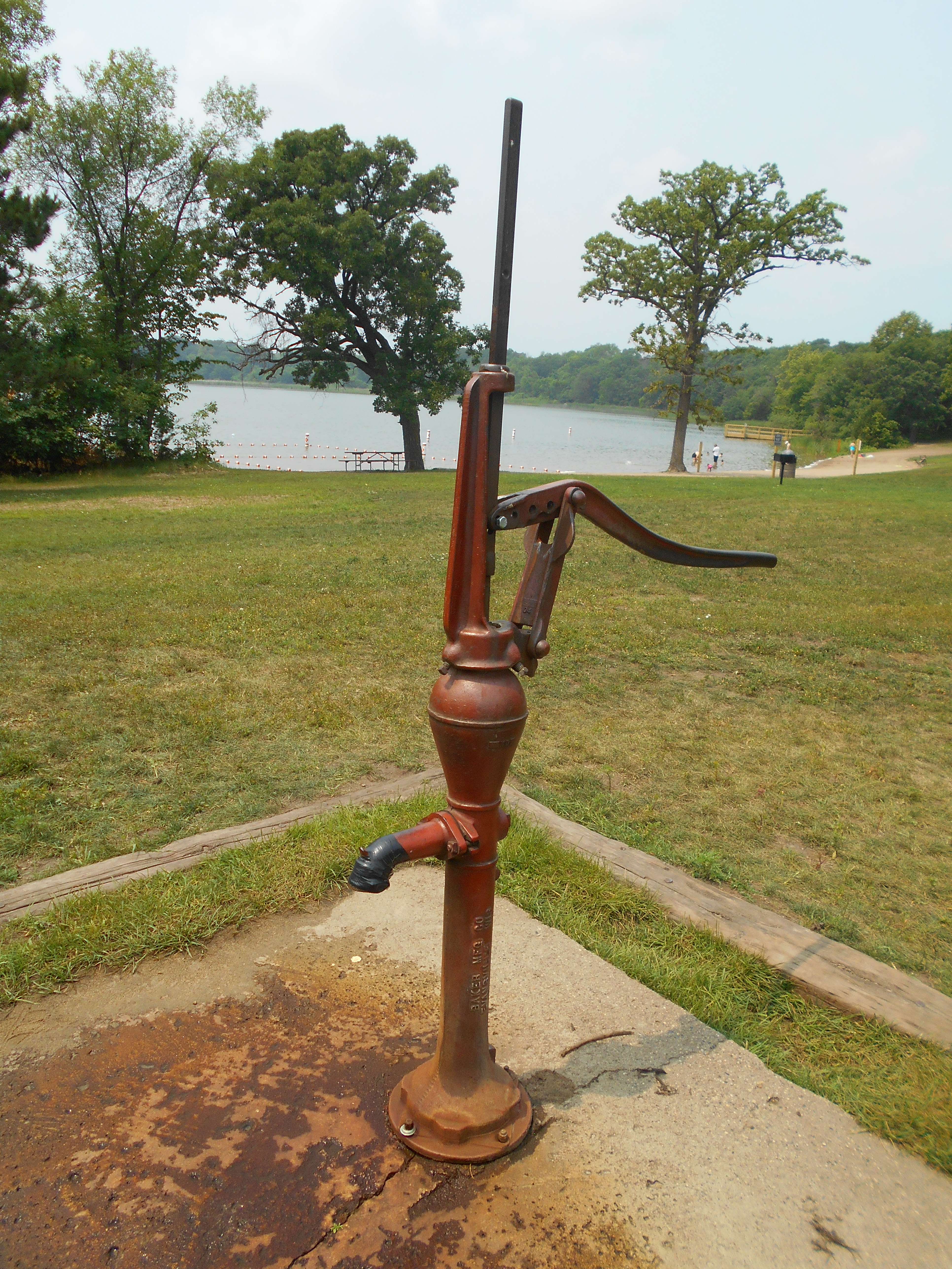 , the beach was accessible by road (driveway) directly connected to County Road 39, so camping may have been more prevalent then.
From the 1960’s thru the 1990’s, the YMCA maintained several sites for camping in the beach area, mostly during the summer months. These sites were located on both sides of the beach. To the southwest, along the northeast corner of Bertram Lake, there were five to six sites available. These were located within the oak and birch trees and were the choice sites. On the west side of the beach along the trail to the old chalet, there were four to five sites available, also within the oak trees. Camping during these times was primarily tent camping with only two pull-behind camper sites.
The only fresh water source for the campers was the pump located by the beach. For convenience, the YMCA installed two porta-toilets at the north side of the parking lot for the campers. At times, these served as changing places for families using the beach.
Native American Evidence at Bertram
 Many people have asked me if there was any evidence of Native American activity around the Bertram Lakes area and I can say that there was. In 2009, when interest in purchasing the area from the YMCA became apparent, the Wright County Parks Department contacted Trefoil Cultural & Environmental Heritage Group to conduct a study of the Bertram Lakes Area. Five sites were located, which I will talk about later.
I must first mention a little background on the Native Americans who used the area and why. One group was the Eastern Chippewa. I say Eastern because they were originally from the upper New York and Canada region but were slowly pushed west as the European/American expansion happened. Most settled in northern Wisconsin, Minnesota and Canada but did range as far south into the area east and northeast of the Mississippi River. Being hunters and gatherers who traveled by river, they had some influence along the rivers.
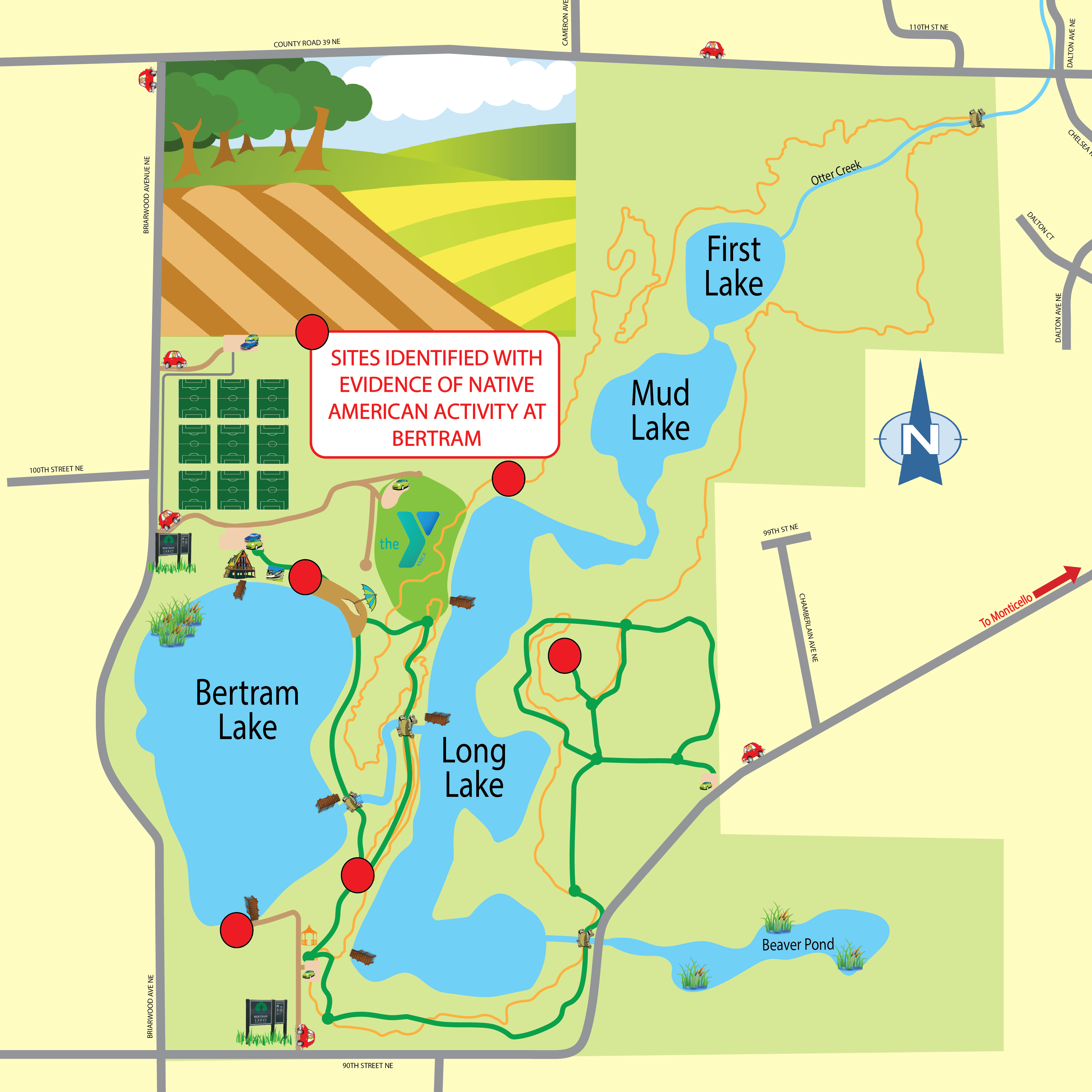
The major group who left their imprint on the area were the Sioux, mostly an extension of the Plains Sioux tribes, primarily Santee. The Sioux tended to be nomadic and moved about the land in a more random fashion. The most common element between the two is that they camped in their movements within 200′ of a water source. Thus, when the study of the Bertram Lakes property was conducted, five sites were identified around Bertram Lake and Long Lake. The sites noted include:
- The north end of Long Lake
- The beach area at the north end of Bertram Lake
- The south end of Bertram Lake near the boat launch
- The open camping area southwest of the old YMCA Camp headquarters building
- The east side of Long Lake on the Kame
In studying the sites, the shovel and sifting method was used. Small pieces of quartz, chert and some remains of pottery were found. All areas had some remnants with the exception of the north end of Long Lake. None of the sites identified qualified for the National Registry.
The results of the survey seem to indicate that this was a “move through” area where natives stayed for a day or two and then moved on. Although, far from being proven, it seems that the Esker may be been the main avenue of travel for the native populations but this is only speculation.
Click the link here to view a map showing the sites with Native American evidence at Bertram.
Otter Creek – The Life Line of the Park
 I find it hard to believe that I have not written about the importance of one of the most prominent aspects of the Bertram Chain of Lakes, Otter Creek. There are many details about the creek (probably even more than I know) so I will mention several.
First of all, Otter Creek begins in the southwest swamp area of Birch Lake. There may be other minor sources but it is hard to tell. It begins and passes through the land that in 1879 belonged to Juilia Bertram, wife of George Bertram. It should be noted that George Bertram died in 1879, leaving this land and several plots of land on West River Street to his wife.
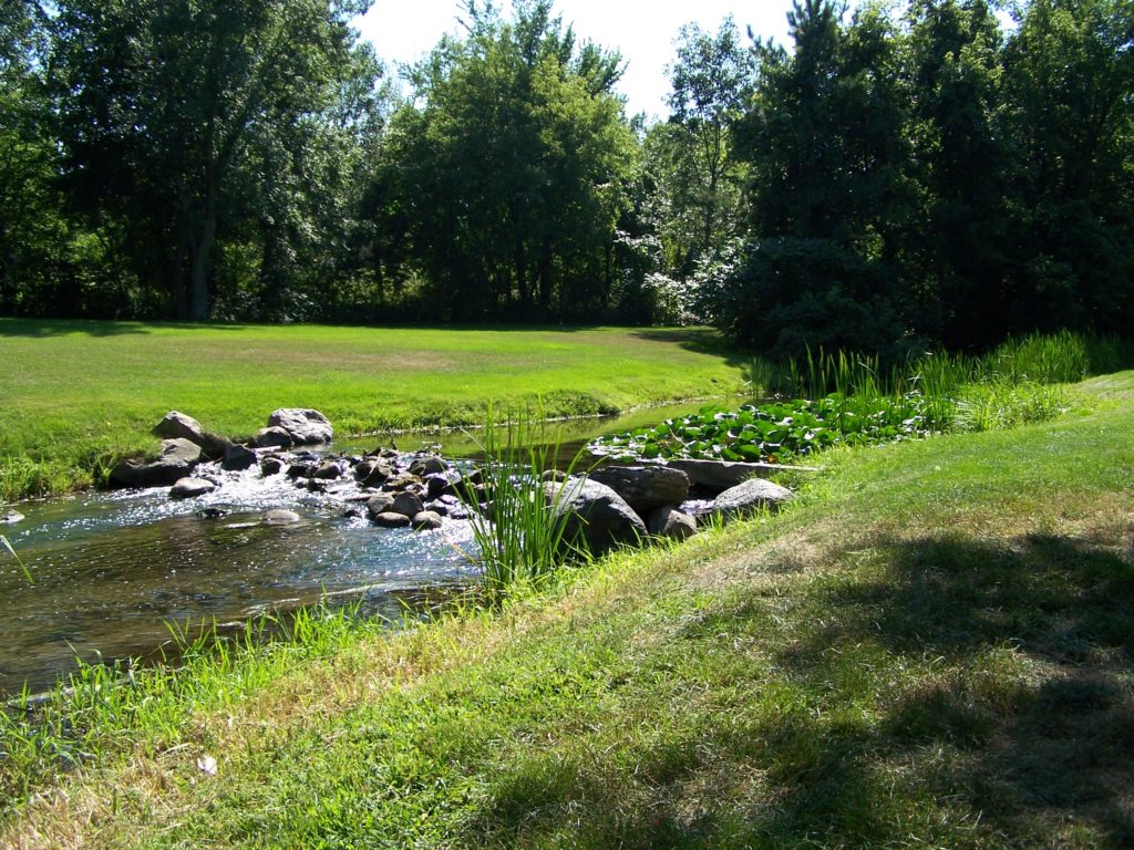
Otter Creek enters Bertram Lake on the west side. In the spring, bow fishermen can be seen hunting suckers because this is a major area for spawning. I hope that is all they hunt. The dam is located where Otter Creek exits Bertram Lake. It was placed there to control the water level of the lake and has done so for almost 100 years (since 1922).
Since the parkland falls in the center of a glaciated area, there are many springs that feed Otter Creek. Between the dam and Long Lake, there are a few minor springs but south of where the creek enters Long Lake, there is an underwater artesian well. If you are ever canoeing or kayaking on Long Lake, feel the water in the middle of the lake and then paddle to south end and feel the water again, you will find a noticeable difference in the temperature between the two.
After Otter Creek exits Long Lake, it flows through Mud and First Lakes. On the north side of these lakes the Portland Cement Company had a processing plant for marl, which is the main ingredient for cement. Over the centuries the fine textured marl would wash off the land and settle in the bottom of the lakes. Portland Cement Co. mined the bottom and eventually enlarged the lakes. Otter Creek then was allowed to flow through them and clean much of the debris.
From First Lake, the creek flows to the Mississippi River passing under County Road 39, under Interstate 94, through the golf course, through Otter Creek Park, under County Road 75, and finally down to the Mississippi River. To my knowledge, Otter Creek has never been dry. Due to the many springs and the Artesian well, it is constantly flowing and because of this, the creek is day after day, year after year, mixing with the waters of the lakes and keeping them clean. This is a wonderful resource and we need to protect it as long as we can.

